.svg)

Baseline Spatial at Lubrecht Forest
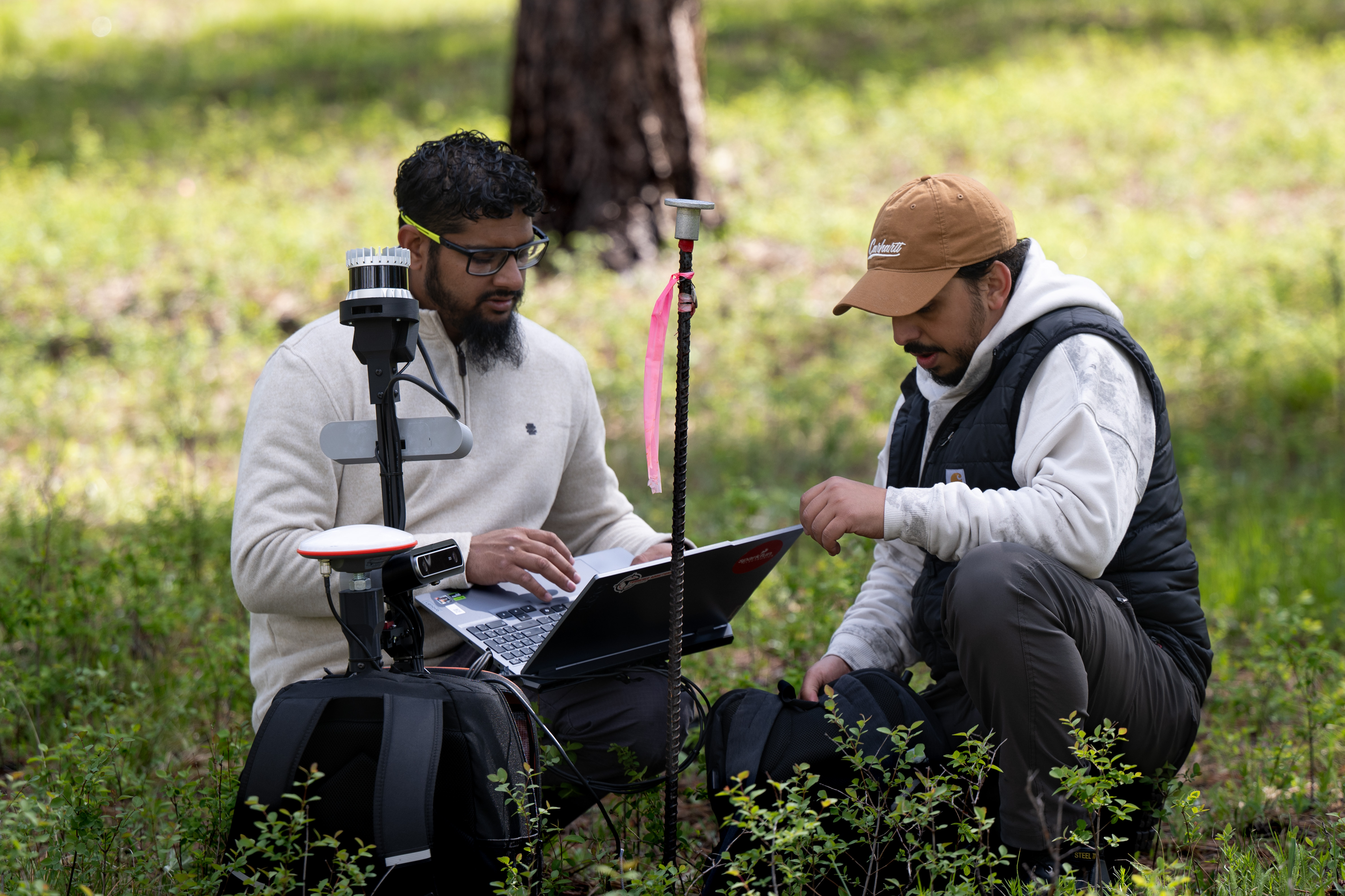
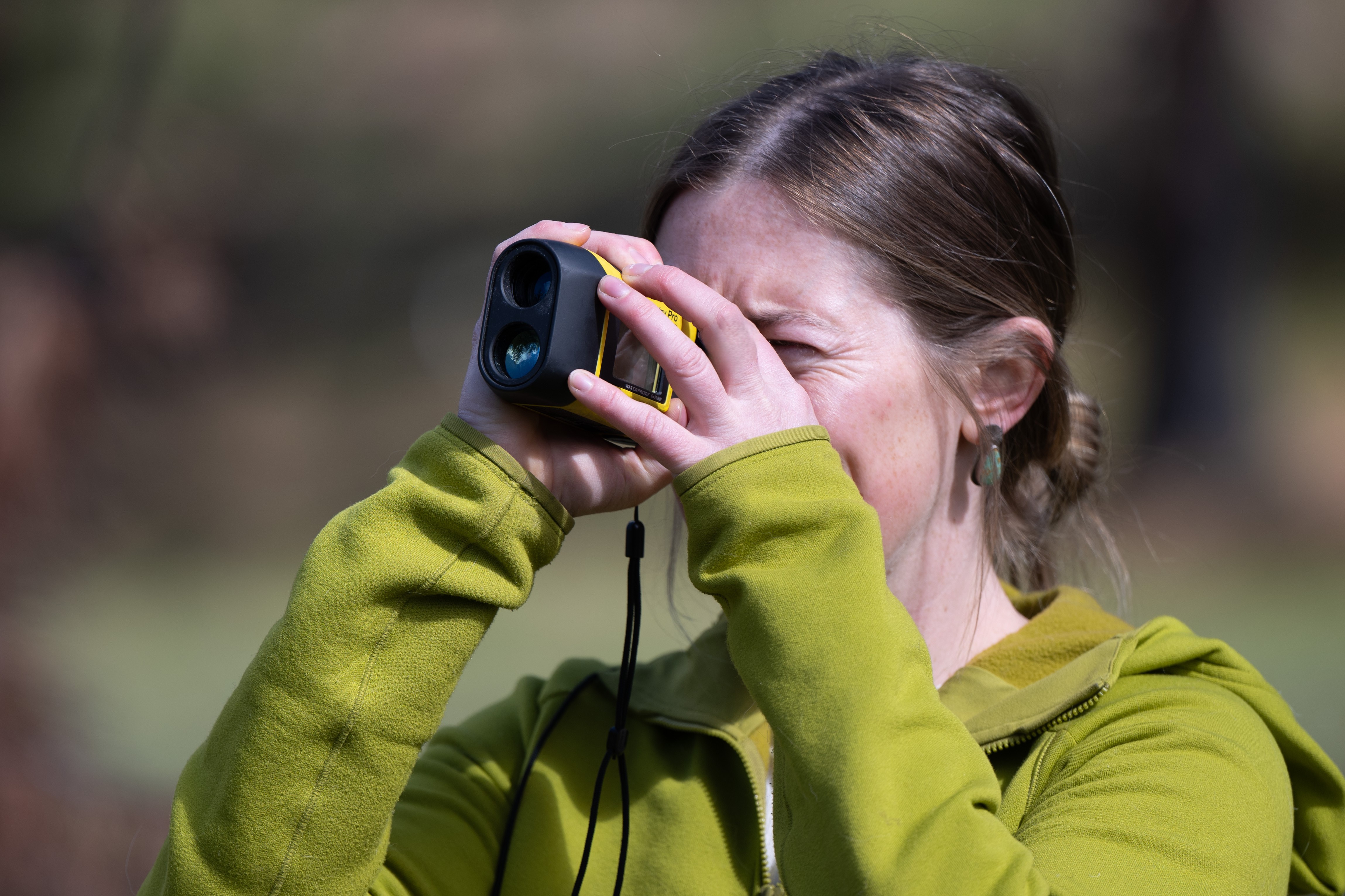
Ibraheem Insanally felt his heart race a little as he and fellow Baseline Spatial LLC co-founder Hassam Alhajaji geared up last month for their third day of field testing at the University of Montana’s Lubrecht Experimental Forest. Their radio had just squawked with word that their guide Isabella Smith, scouting ahead through the understory, spotted a black bear in the area. Though the pair weren’t fully braced for that exact scenario, the initial shock quickly eased into an acknowledgement of their shared respect for the woods and their denizens.
“It's a controlled environment,” Insanally said, “and it’s still a challenge.”
Fittingly, that respect is precisely what brought the two Billings-based entrepreneurs out to the Lubrecht testbed. Alhajaji and Insanally are currently fine-tuning a system for mapping the very environments they find so inspiring, utilizing a mobile LiDAR sensing rig to create a spatial inventory of the forest floor. During the May testing window, Baseline Spatial conducted several ground treks through burned and unburned plots at Lubrecht. Those outings gave Alhajaji a host of inventory data to process and compare to field measurements taken by Smith, and offered Insanally an opportunity to troubleshoot various physical aspects of Baseline Spatial’s hardware.
Baseline Spatial’s visit marks another successful synergy for the Headwaters Tech Hub, which brought Alhajaji and Insanally together with Lubrecht’s cadre of local forest experts. UM ASSIST Project Coordinator Tori Anderson noted the benefits of the collaboration cut both ways: for Baseline Spatial, an opportunity to fieldtest a new way of inventorying the environment, and for UM, an opportunity to engage with a cutting edge technology that could reshape the mapping of forest understories.
“Having all these minds together, bouncing ideas off of each other, has just been really inspiring to witness,” Anderson said, noting the constant back-and-forth between Alhajaji, Insanally, Smith and UM’s Scott Ferrenberg.
In just a few days, that amalgamation of perspectives has done wonders to nudge Baseline Spatial further along the path of refinement. The company’s remote sensing rig already improves radically on the original prototype, assembled nearly five years ago at the University of Hawaii to meet the rigors of a vastly different environment. And Insanally is coming away from the Lubrecht testbed with a list of even more alterations. Some will iron out kinks related to comfort and support, namely a belly strap to help shift the weighty load of electronics closer to the wearer’s waist. Others reflect a need to maximize user movement through underbrush thick with potential blindspots, or occlusions, while offering better protection for the rig’s costly sensor equipment.
“We’ll have to have a shield to kind of protect the LiDAR from those dense places,” Insanally said, “because there's no path you can go through to reduce those occlusions that would allow you to clear the height for the trees or the branches, and it will scratch the lidar or another sensor.”
Encountering those natural hurdles in real time is critical to building toward Baseline Spatial’s end goal of adding new layers to our digital understanding of forest environments. Scientists like Smith have already devoted countless hours to transecting areas like Lubrecht and mapping the understory by hand. Emerging applications of drone technology are adding a literal 100-foot view to that picture. The sensor-heavy backpack Insanally and Alhajaji now plan to shoulder through the woods plugs a key gap in those datasets, creating a three-dimensional forest inventory that can illuminate ecological features, wildfire fuel loads and other critical aspects of the physical world. Given the long tradition of forestry and photonics work in Big Sky Country, Alhajaji said Montana seemed like a “natural fit” for a company specializing in the environmental applications of remote sensing technology.
“We have enough forestry [in Montana] that I just saw a space and a need for this type of work,” he added. “We are becoming increasingly data-driven, and I think this kind of data in forestry should be available to all parties involved, whether passively or actively, at a research level or at a commercial level. Data-driven decisions are the future.”
In that regard, working alongside Smith provided Baseline Spatial’s co-founders with not just a seasoned guide through Lubrecht’s understory but a ready source of end-user feedback. Having recently graduated with her master’s in systems ecology from UM’s W.A. Franke College of Forestry and Conservation, Smith appreciated the opportunity to glimpse the future of forest data collection in the making and weigh in on potential solutions to practical problems for those in the field.
“They have so much knowledge about this sort of stuff that I don’t know anything about, except I know what happens to the data,” Smith said. “So I’m able to give them some ground-truthing, help them understand how the forest works, and offer some ideas about what this backpack can do, the information it can give and the problems it can solve.”
The breadth and impact of those potential applications have been on the minds of Alhajaji and Insanally since they first made the move to Montana, a drive that took them through Yellowstone National Park and a series of captivating views of mountains, forests and moss-covered waterfalls. At the end of a long day at Lubrecht, that’s what the duo sees as Baseline Spatial’s goal: to contribute to ecological balance, to wildfire management, and to any other needs of the resource and those who utilize it.
“I'm just happy to be here to help out with that,” Insanally said, “to add value in any way that I can.”